
- 142,161
- City population
- 1,486,758
- District population
- 16 km
- To Taunsa Barrage
- 2022
- District since
PBS census 2023 · city
PBS census 2023 · Kot Addu District
Municipal geography
Announced Oct 2022 · notified Dec 2024
Stories
Latest from the Indus plain

Culture · 2 min read
The shrine of Din Panah
A blue-tiled tomb north of Kot Addu, a foundling saint claimed by both banks of the Indus, and a century of pilgrims — from the district gazetteers.
Read →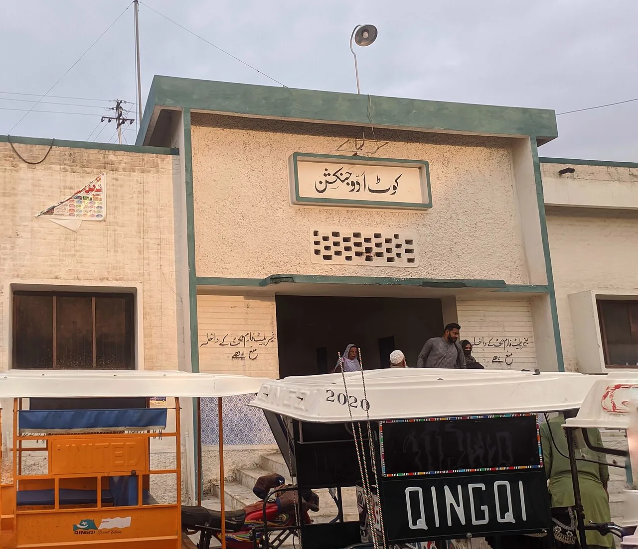
History · 2 min read
Kot Addu Junction
The railway reached Kot Addu in the 1880s. Eighty years later a bridge across Taunsa Barrage made the town a junction on the route from Karachi to Peshawar.
Read →
Industry · 2 min read
Mangoes, citrus and cane
Two canals and two very large sugar mills shape the fields around Kot Addu. The official figures — and what the heat is doing to the mangoes.
Read →People
Voices of the district
From the Saraiki kafi of Pathanay Khan to a Mughal-era saint, a Hindi poet born at Daira Din Panah and the Flying Sikh — people with a sourced link to Kot Addu.
Meet them all






Towns
Beyond the city
Tehsil Kot Addu · 37,644
Daira Din Panah
The shrine town north of Kot Addu, named after the saint whose blue-tiled tomb stands at its centre.
About Daira Din Panah →Headquarters of Tehsil Chowk Sarwar Shaheed · 63,421
Chowk Sarwar Shaheed
Once Chowk Munda, now the headquarters of the district's second tehsil — a growing town in citrus country.
About Chowk Sarwar Shaheed →
Tehsil Kot Addu
Mehmood Kot
An old fort town that became the oil junction of the district: PARCO's Mid-Country Refinery, tanker depots and oil trains.
About Mehmood Kot →
Tehsil Kot Addu · 40,593
Sanawan
A low-lying river town south of Kot Addu — home ground of the Khar family and the Fatima sugar mill, and often the first place the Indus floods.
About Sanawan →
The Indus
Sixteen kilometres to the barrage
The river shapes everything here: Taunsa Barrage holds the water that feeds the canals, the fields and the dolphins below its gates. October to March is the season to come — cooler days and good barrage light.
- Best season
- October to March
- Railway
- ADK
- Nearest airport
- Multan
What's on
Dates in the district's year
Recurring gatherings with a sourced date. Lunar dates move each year.
9 March
Kot Addu
Pathanay Khan's death anniversary
Local singers and his family gather in Kot Addu to sing his kafis; the 25th anniversary in 2025 was marked with the Deputy Commissioner.
Read more21–22 August
Daira Din Panah
Urs of Din Panah
The annual urs at the blue-tiled shrine of Din Panah, north of Kot Addu.
Read more8–9 Dhul Hijjah
Basti Parhar Gharbi, near Kot Addu · Islamic calendar
Urs of Allama Abdul Aziz Parharvi
The urs of the 18th–19th century scholar at his shrine outside Kot Addu.
Read more